


Research Group
Geospatial analysis, environment and Amazonian territories
The Geospatial analysis, environment and Amazonian territories Research Group is an interdisciplinary research group that focuses on the use of geospatial technologies and methods to generate knowledge on the spatial dimensions of socio-environmental systems in Amazonia. Primary scientific questions are related to the spatiality of ecological and social processes and structures and their interactions; the group also study themes related to the spatiality of the physical environment. Researchers seek to efficiently address current regional challenges by proffering spatially explicitly scientific knowledge that provides support for conservation and the sustainable use of natural resources.
Geographic Information Systems (GIS)
Is an integrated system, involving hardware, software, spatial information, computational proceedings, and human resources, which allows for and facilitates the analysis, management of space and its phenomena. The Mamirauá Institute uses GIS in research on conservation and biodiversity. GIS supports, for instance, analyses related to Movement Ecology, which seek to identify aspects related to how fauna move within the environment. Questions include: How do animal reproduction characteristics relate to movement? Do environmental attributes interfere with animal movements? And if so, how? These types of analyses can help respond to questions of species conservation. Other uses of GIS include understanding how spatial-temporal patterns of floods influence regional biogeochemistry and forest structure.
See some images created by the group:
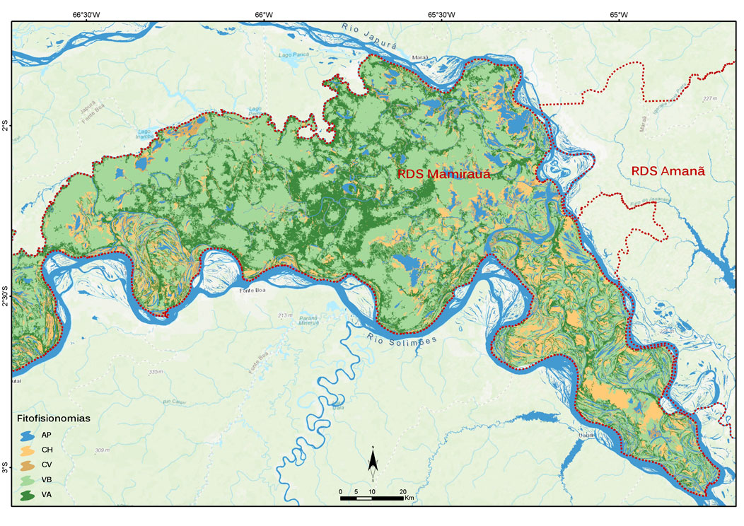
Phytophysiognomy of the Mamirauá Sustainable Development Reserve: :
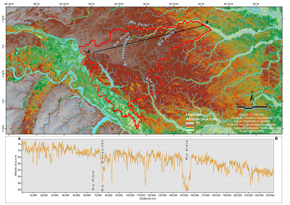
Topography of the Amanã Sustainable Development Reserve:
Funders


 Access to information
 Webmail